There may be times when you need to search for listings within a very specific area but using the County/City/Neighborhood fields is just not granular enough. For instance, you may have a buyer who only wants to see properties within a small group of streets/blocks.
Thankfully, connectMLS makes it very easy to accomplish this task.
When you are on a search screen, use the Map Boundaries field to get started:
When you click the Click here to draw or select boundaries link, the screen will split- the search screen will shrink down to a column on the left and the remainder of the screen will be an interactive map:
In addition to zooming in/out and dragging the map in all directions (N, S, E, W), there are many other ways in which you can interact with the map and narrow your focus to what your buyer is looking for.
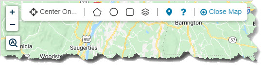
There is a series of icons in the upper left corner of the map:
 Zoom in on the map to see more details.
 Zoom out to see more overall area.
 Autozoom when viewing Detail listing reports- If you have the Full Detail report pinned to the right side of the screen, the map will refresh and center on the listing you are currently viewing.
 Allows you to center the map on a specific address (enter an address or use your current location, office address, etc.).
 Polygon drawing tool- Use this tool to draw an irregular shape (not a circle/rectangle) that conforms more accurately to your area of interest.
 Circle drawing tool- Search for properties within a circular area. Either enter a specific radius (1 mile, for example) or use your mouse and drag outward to create a circular area of interest.
 Rectangle drawing tool- Drag your mouse cursor down and across to create a square/rectangular search area.
 Map layers- Apply different layers to the map and outline counties, cities, flood plains, etc.
 Hide/show map pins- Toggle between displaying/hiding listing pins on the map.
 Map control hints- Provides tips for using the different map drawing tools.
 Close the map completely and go back to the full search screen.
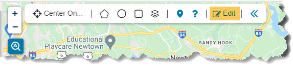
If you have used one of the drawing tools (polygon, circle, rectangle) to draw an area on the map and would like to remove it, click the Edit button in the top of the map:
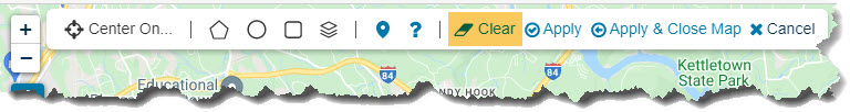
Click Clear to remove the area from the map:
Comments
Please sign in to leave a comment.